Day 6 - St. George to Henderson, NV - 199 miles
156
Not much to do today. Just part of the big loop around to get over to the western flank of the Sierras.
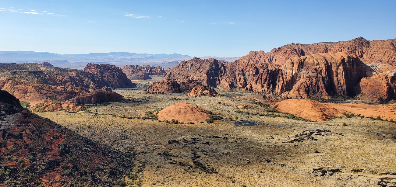
I spotted what looked like an interesting state park just north of St. George. We make it the first stop before heading south. It's about a dozen miles north on UT Hwy 18.
157

Snow Canyon Scenic Overlook - the sign on the side of the road is about 2 inches high and barely visible. Weird.
158
159
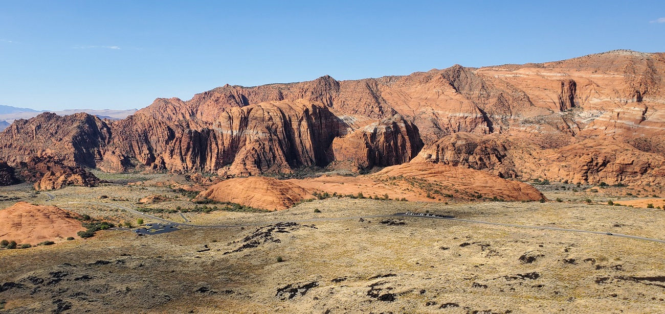
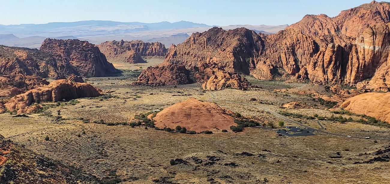
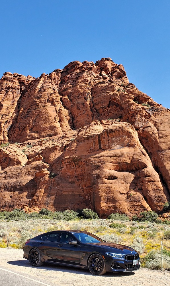
Nice spot for pictures. Maybe I could start a side hustle taking wedding photos. I might know of a few places for some great pictures.
160

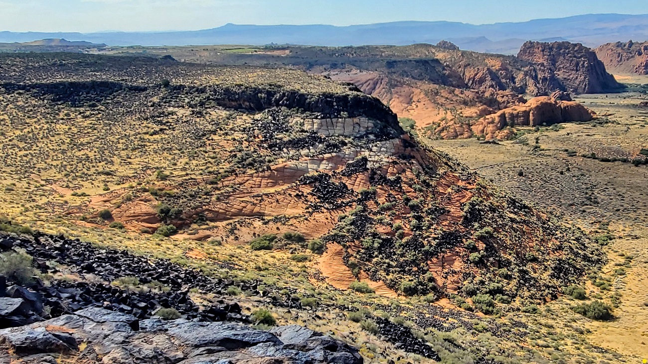
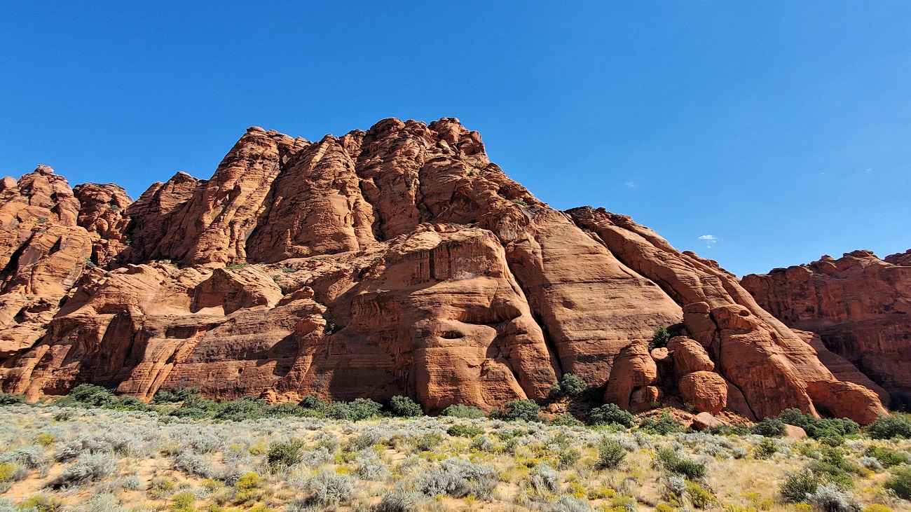
The orange, black and green make for an interesting landscape - quite unusual.
161
162
163
164
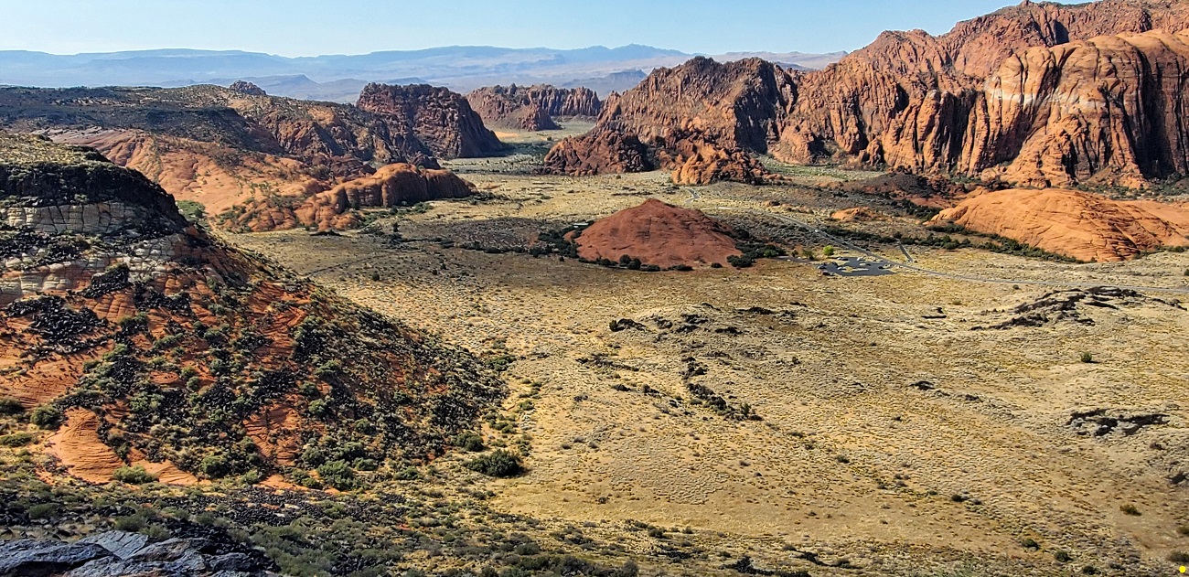
We make our way down to the valley floor. There are several hiking trails..............that we do not partake of. It's hot.
165
166
167
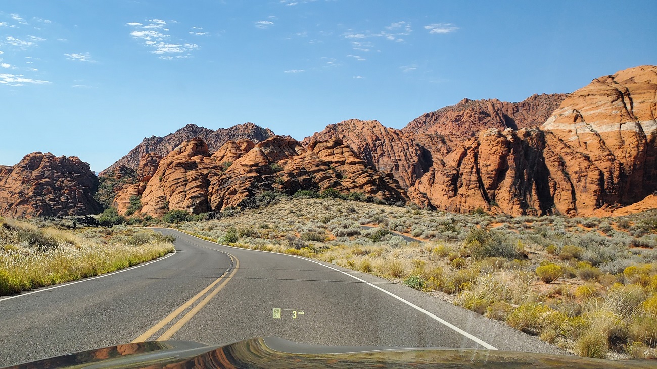
In 4 short miles we are out of the park and into the fancy St. George suburbs. This place has exploded in the last 15 years.
168
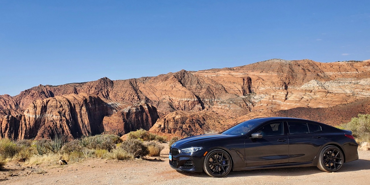
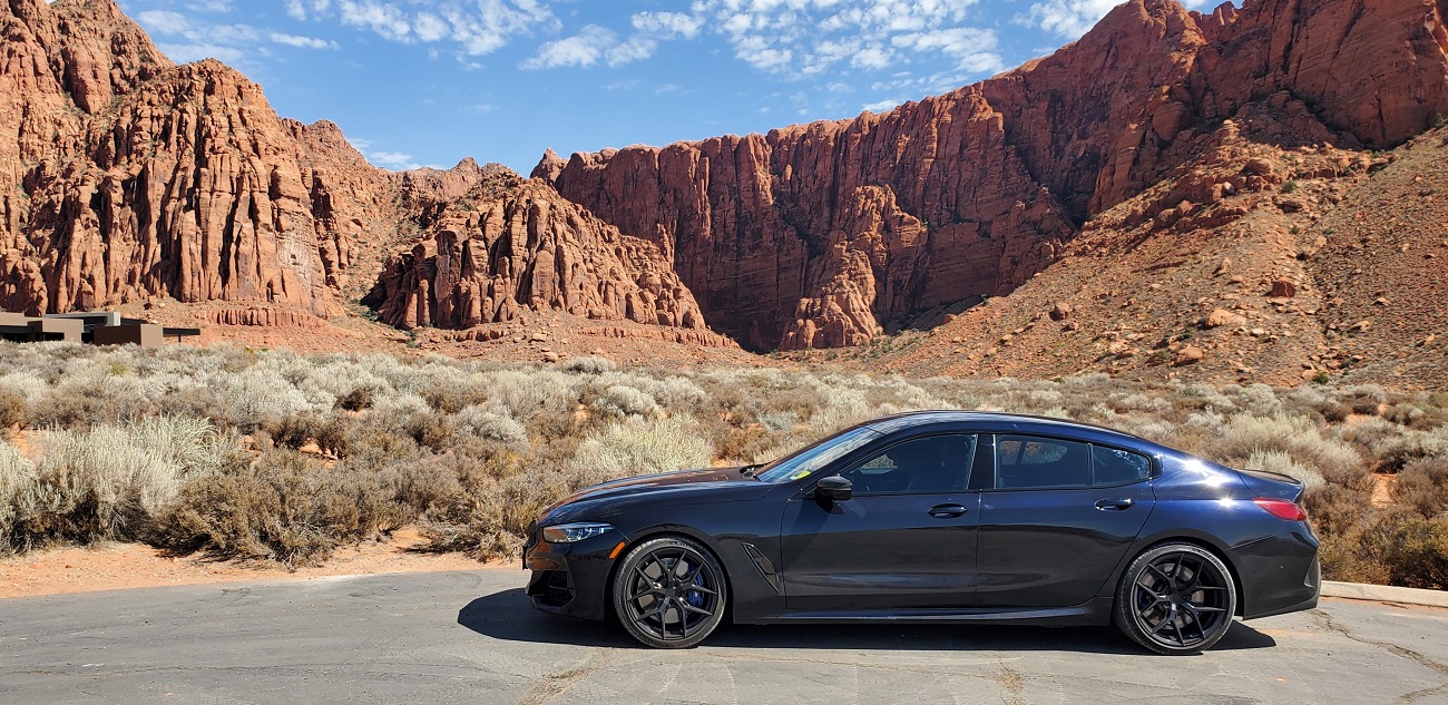
We drive up into a neighborhood with large lots, expensive low slung homes and and an interesting back drop. The house is at the left edge of the photo.
169
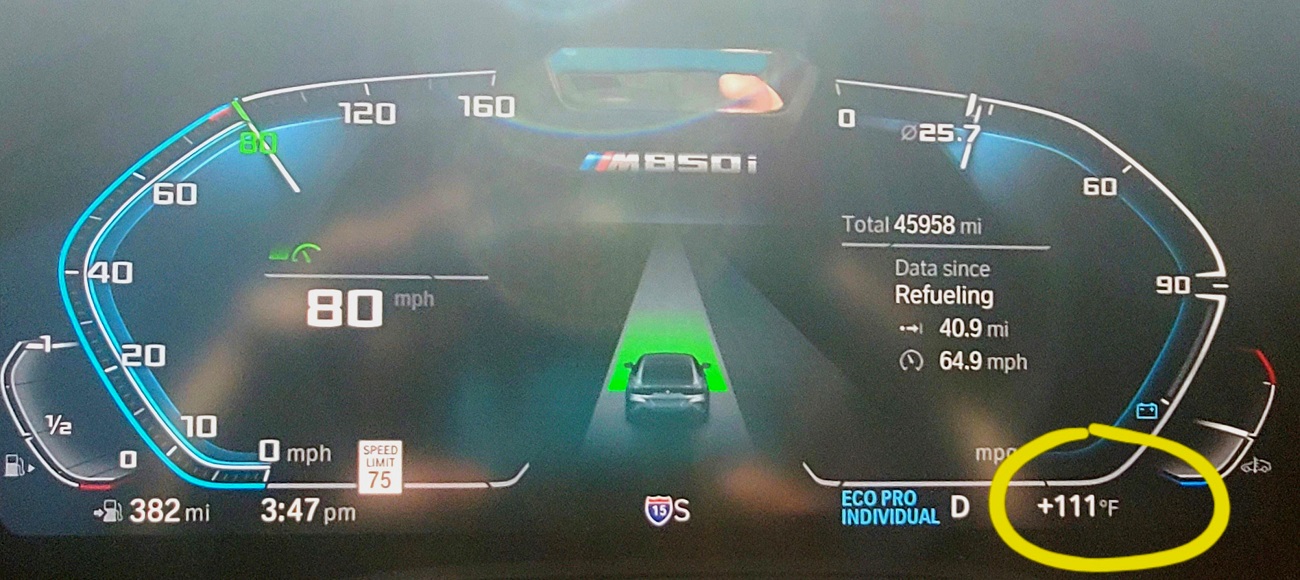
We go have lunch, tour downtown St. George and hit the road for Vegas on I-15, another new stretch of road for us. We soon drop into Arizona and the terrain becomes quite mountainous. In 30 miles we pass into Nevada. It's really hot and dry.
I grab a quick snap of the outside temp. It was just 112F a minute ago. Hey, I'm getting 25.7 mpg at 80 mph. Cool.
170
We turn off south on NV Hwy 189 and take a great little 2 lane road that cuts through the Lake Mead National Recreation Area for about 75 miles, and then in to Henderson at the southern edge of Sin City. It's still 105F when we head out for dinner. And 2.3 million people live here, for some reason. Did I mention how dry it is.
Day 7 - Henderson to Three Rivers, CA - 379 miles
171

Time for a long and boring day. And hardly anything to take a picture of. Unless you like brown dry desert.
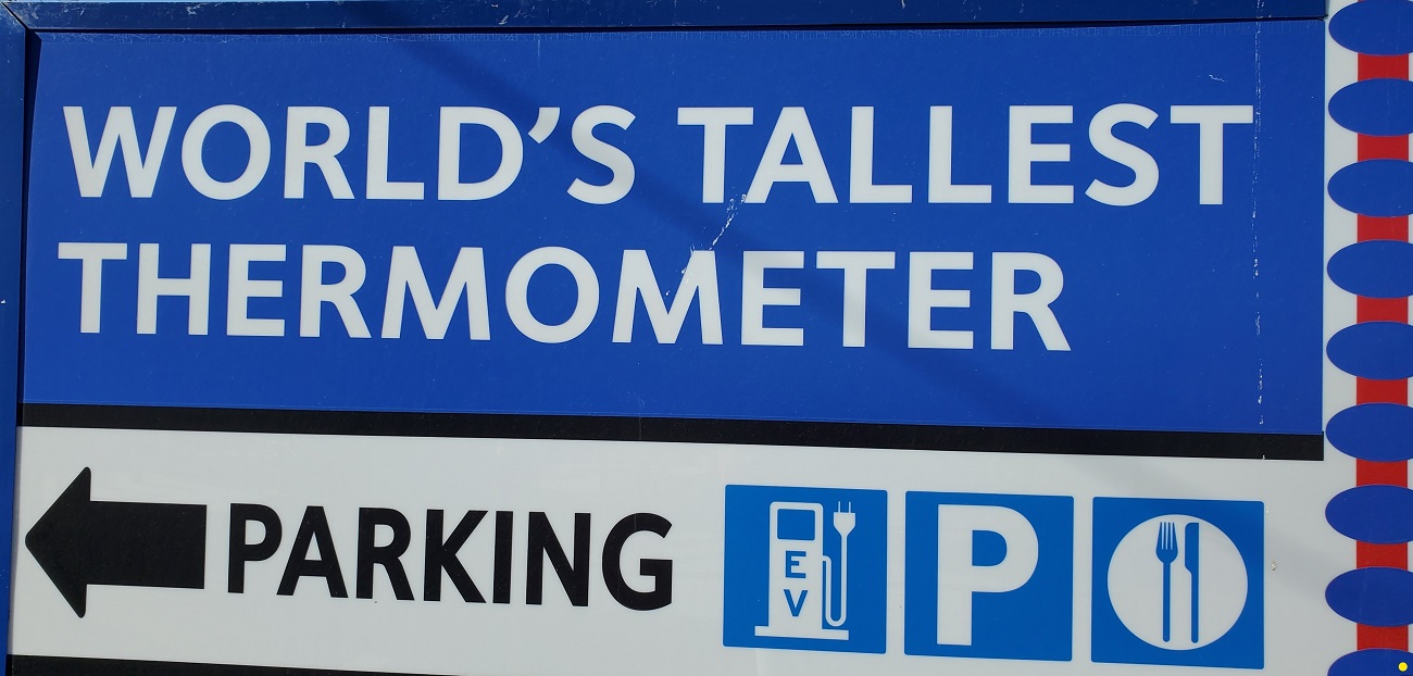
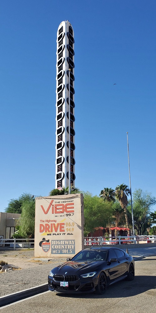
Back on I-15, we soon hit the soul sucking 145 mile stretch of the god forsaken Mojave Desert. Luckily it's only two hours, and I was able to find a spot to break up the monotony for a few minutes. The little town of Baker, CA at roughly the halfway point.
172

Because, you see, Baker is the home of the worlds tallest thermometer!!! A majestic 134 feet tall.
173
174
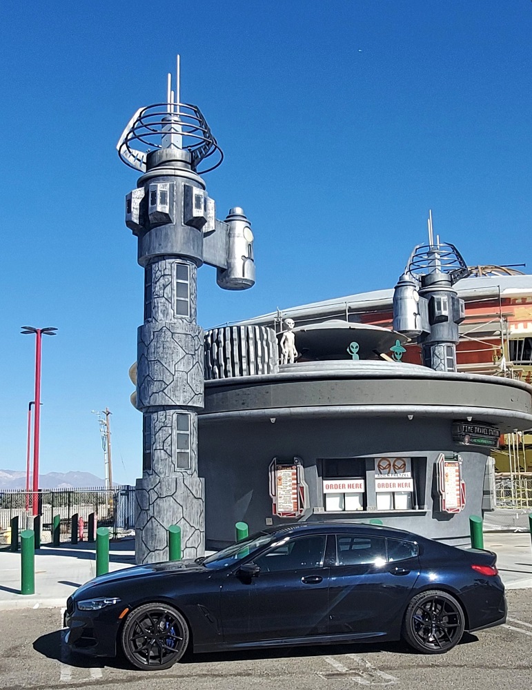
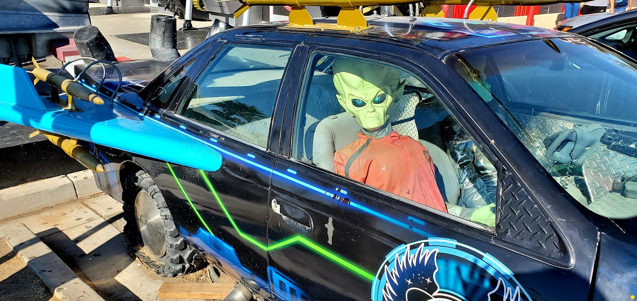
But wait, there's more!! Alien Fresh Jerky horns in on the action.
175

176

177
178
Back on the freeway, we blow through Barstow and skirt the north edges of Edwards Air Force Base - home of the Space Shuttle landings, and a few other odds and ends over the years. Tehachapi finally brings relief from the desert and we pull in for a nice lunch 235 miles into the day.
Generally I'm loath to venture into big cities if I'm not staying there, but we'd never been through downtown Bakersfield. It's Sunday, so we give it a try. It's been an energy and agricultural hub for over a century and the area has nearly 1 million people. Traffic isn't bad at all, we take a few pictures (none turned out) and we set our sights on the final destination.
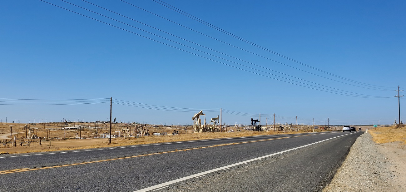
We head north on CA Hwy 65 and pass through a vast oil field area with thousands of oil donkeys pumping away. There are neighborhoods on the west side of the road and oil wells on the east side. Eventually the city ends and its just oil fields.
179
Oil finally gives way to farming and it's orchard after orchard, with millions of trees, as far as the eye can see. We think they are lemons. Billions of them. For miles..............
We are on the western flanks of the Sierras, and after 65 miles of lemons we turn east and shortly arrive at Three Rivers - a gateway to Sequoia National Park.
Gonna see some big trees tomorrow.
Day 8: Three Rivers to Cedar Grove, CA - 91 miles
180
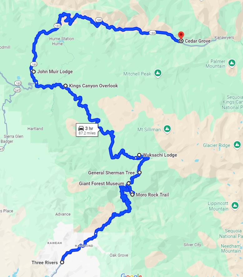
We hook up to the Generals Highway and reach the entrance to Sequoia after only 7 miles. A quick stop at the Visitor Center and then we're off - steadily climbing up the Sierras on a slow winding road.
181
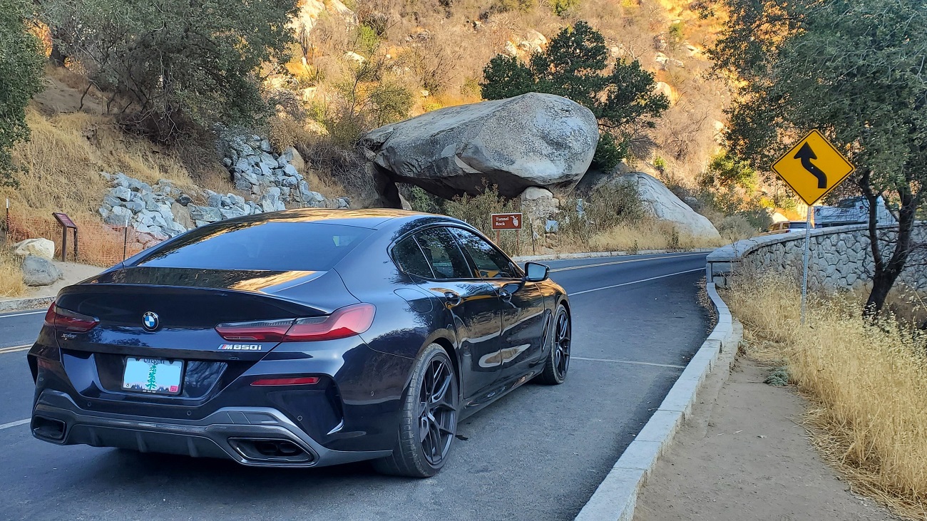
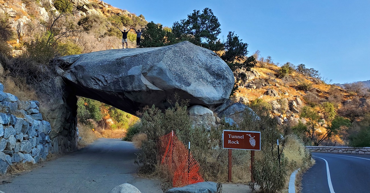
First up is Tunnel Rock. I believe the road actually was routed through here at one time, then the rock shifted. Don't know who these people are, but they wouldn't leave.
182
183
It's very dry going up the mountainside. We are trying to climb above the brown haze that we have been in since we crossed into California yesterday. The pictures at all the vista points don't yield much. There is burn damage everywhere.
184

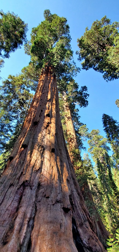
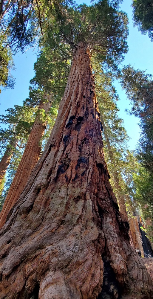
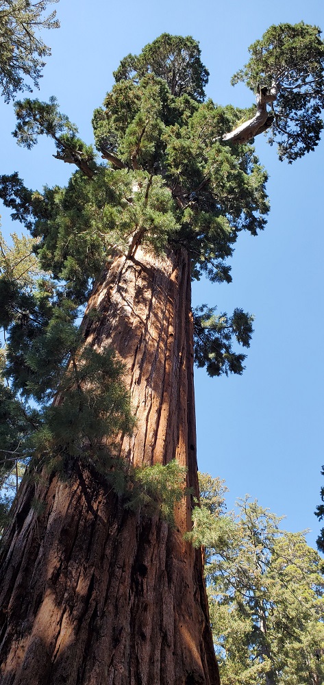
The big trees (Giant Sequoias) show up at around 6,000 feet. They thrive in a very specific climate zone. We stop at the Giant Forest Museum and head out on to the Big Tree Trail.
185

Now we're talking
186

There's something magical about a tree that is 250 feet tall and might be 2,000 years old.
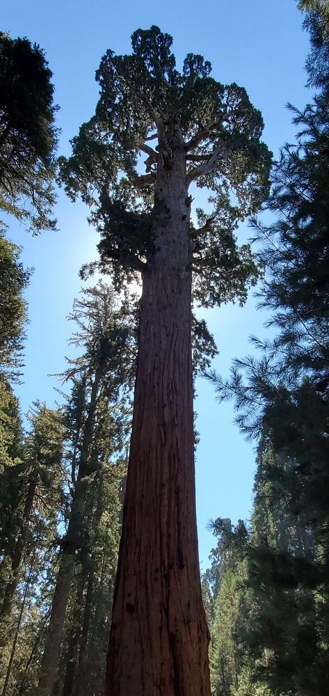
187
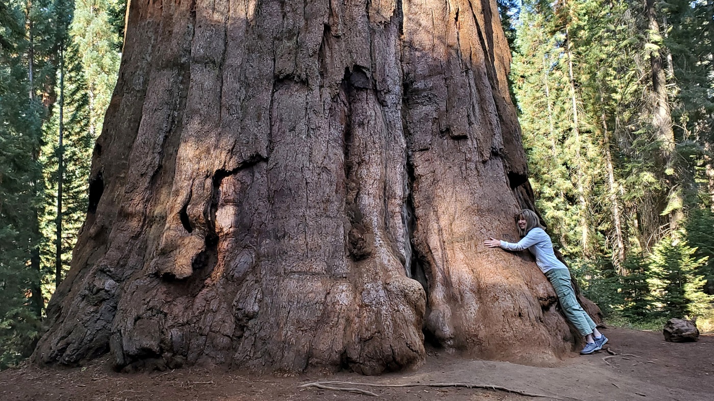
Same tree at the base - for scale. Wow, a tree hugger married to a guy driving a fire breathing V-8. Go figure.
188
The trail winds around a spectacular grove of the big fellas. I present:
The Mullet Tree
189

190
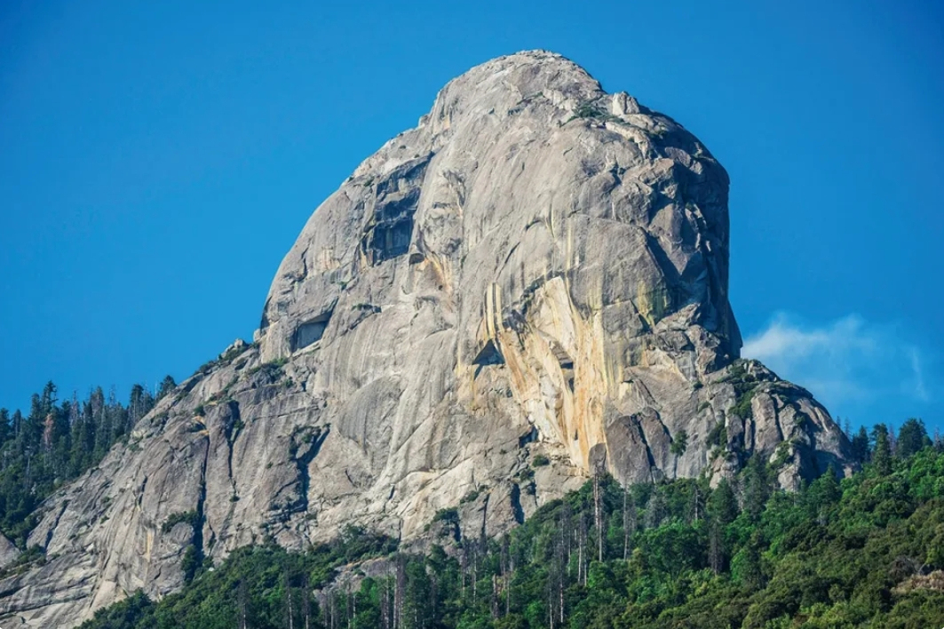
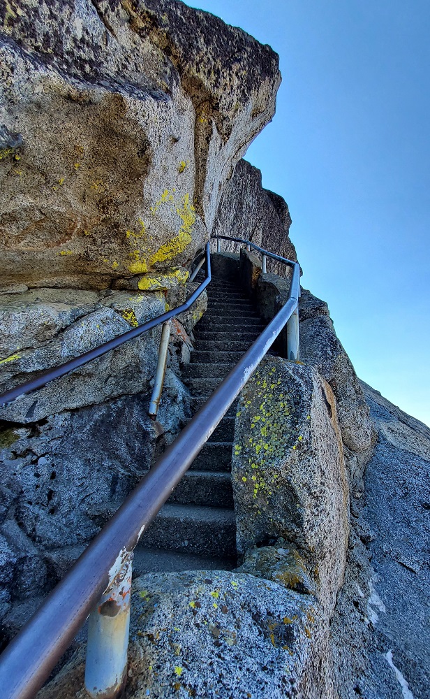
Moro Rock is a short drive and I read there is a fun trail to the top. I'm in.
191
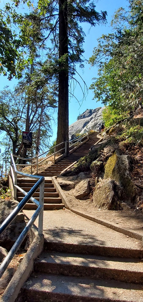
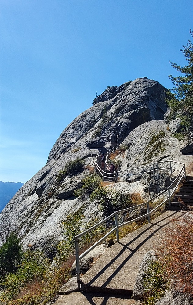
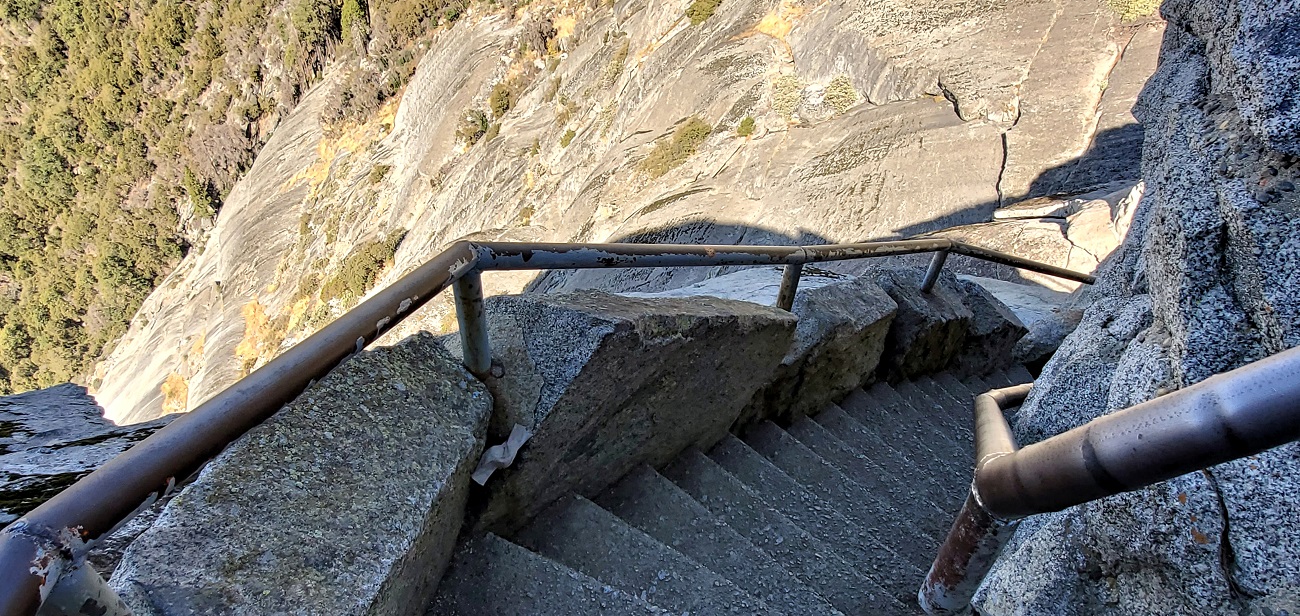
Parking is at a premium, but we find a spot. The trail is only a half mile, but there are 300 vertical feet and 350 steps to to navigate. And maybe a little exposure.
192
The wife bails about here. Just me again.
193
Steep steps
194
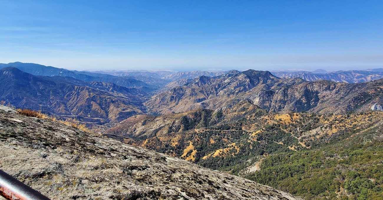
We are rising above the haze over the vast San Joaquin Valley to the west.
195
Summit run
196

197

198

The view east across the Sierras
199

The way down
200
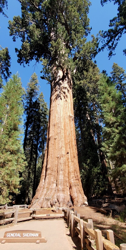
Back in the car, we wind our way over the the General Sherman Tree. It's not too far off the road, but the parking has been turned into a shuttle stop and disabled parking only. We continue on and drive nearly 2 miles to a large parking lot.
You pick up a trail that descends 200 feet and 3/4 of a mile to the grove.
201

The General Sherman tree is the largest tree on earth, by volume. It is 275 feet tall and 103' in circumference around the base. There's enough wood for fifty 2,000 sq ft houses. It's big.
202
203

The wife heads down to the shuttle pick-up. I hoof it back to the car. Getting my steps in today.
We wander over to Wuksachi Lodge. Nice place - not my picture. I'd stay here.
204

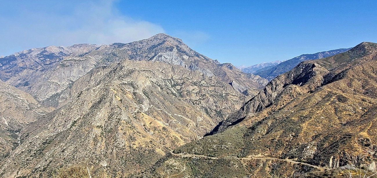
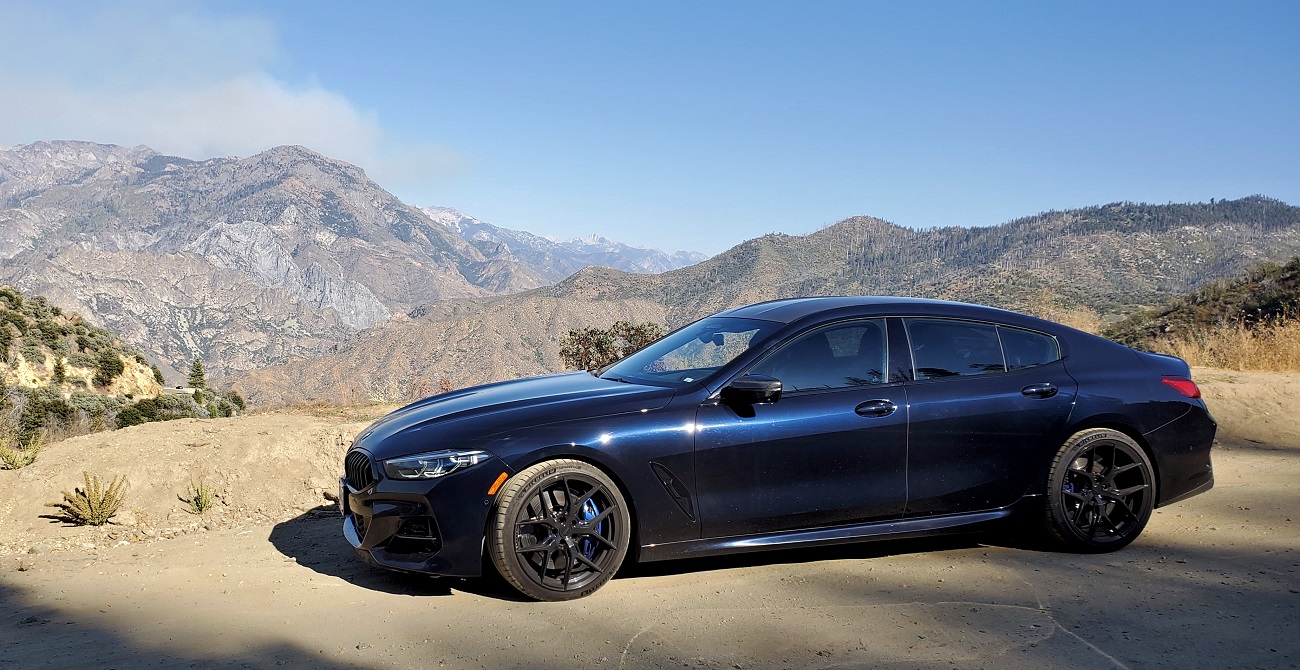
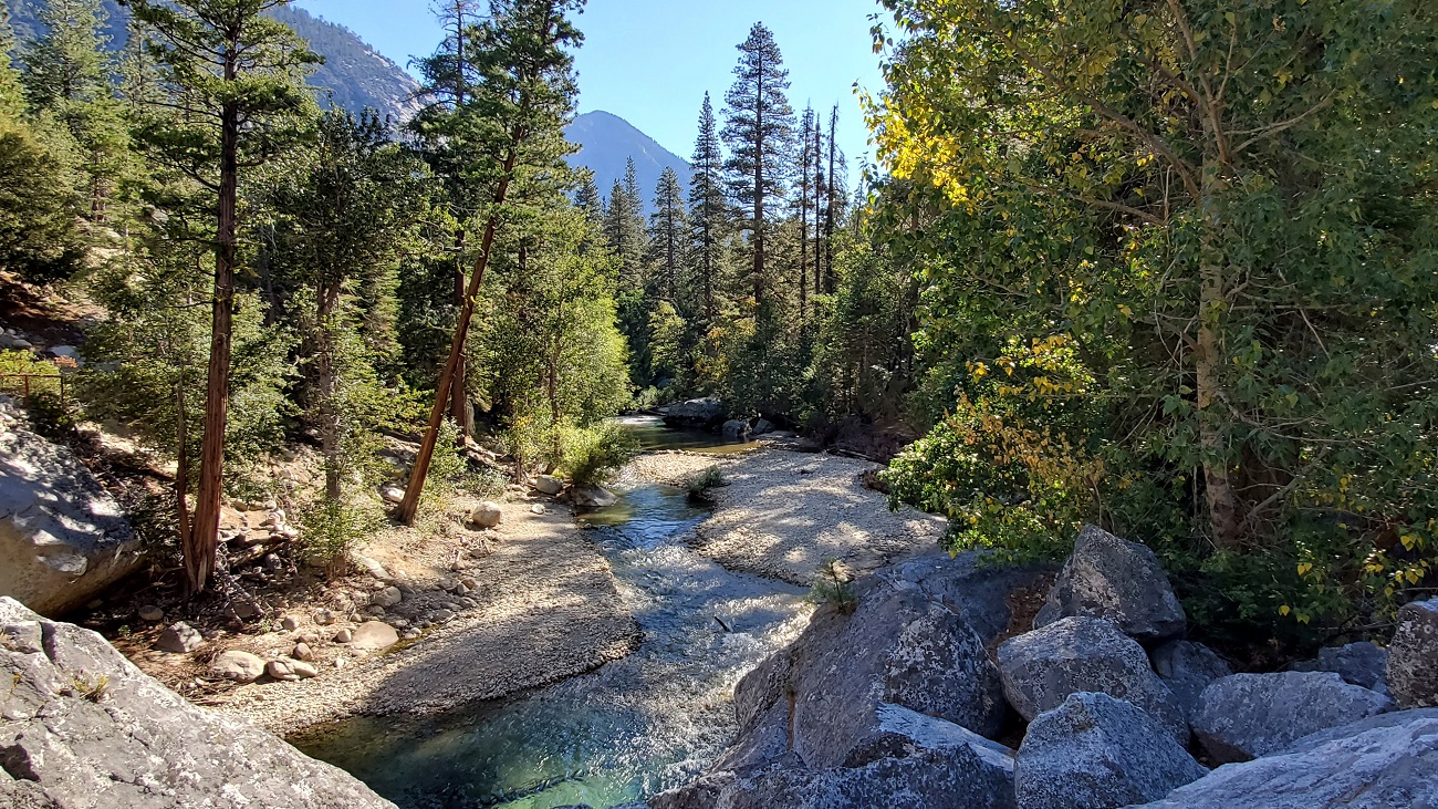
The road stays at about the same elevation (7,000 feet?) and we meander along the Sierras. Lots of fire damage. The Sequoias seem to be in groves - it's not like the mountainside is covered in them. Several viewpoints only yield hazy things in the distance.
Redwood Mountain Overlook - best I can do. We are now in Kings Canyon National Park.
205
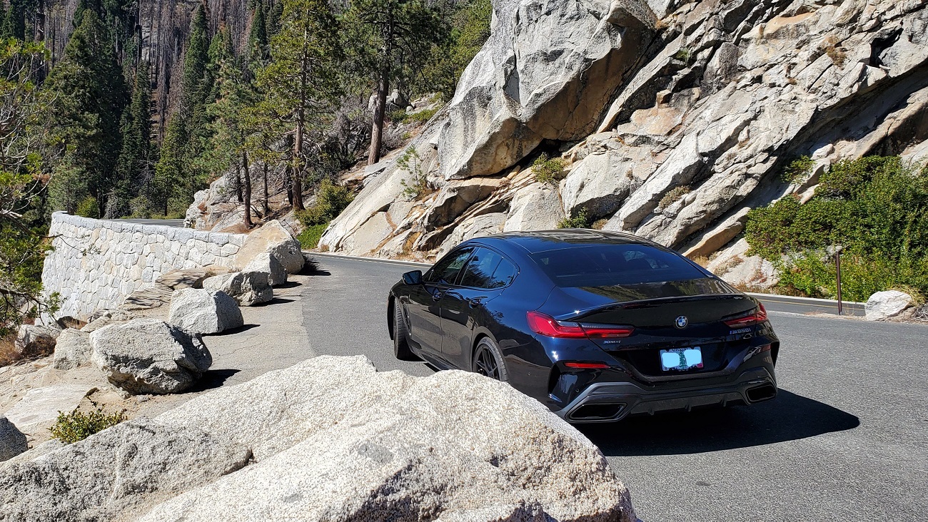
We descend into Grant Grove Village and take a peek at the John Muir Lodge and check out a lunch spot for tomorrow when we come back through.
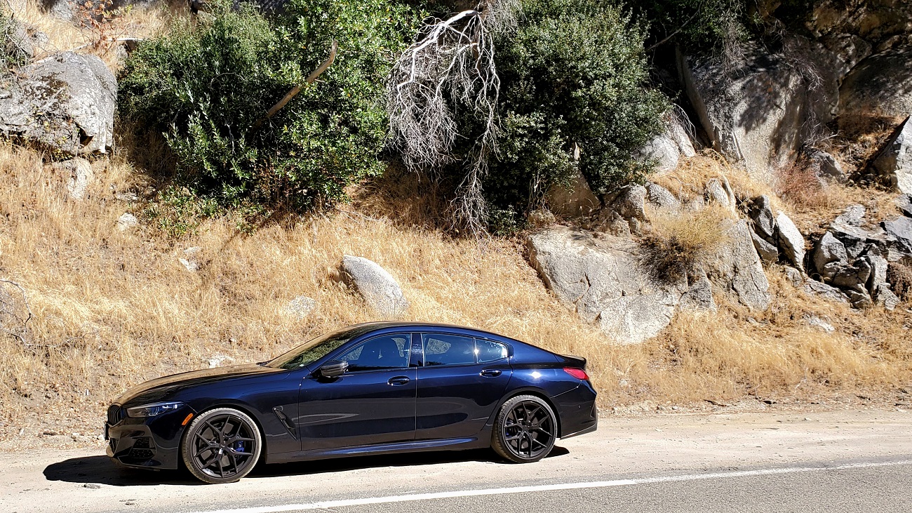
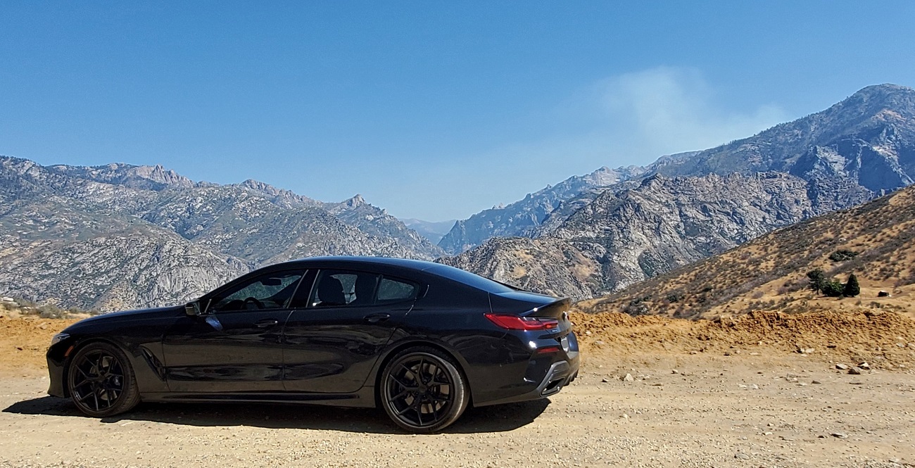
We hook on to the Kings Canyon Scenic Byway and make our final 30 miles to Cedar Grove for the night.
Junction View
206
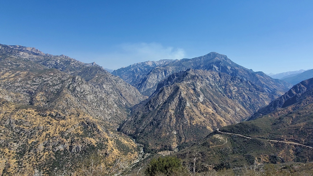
207
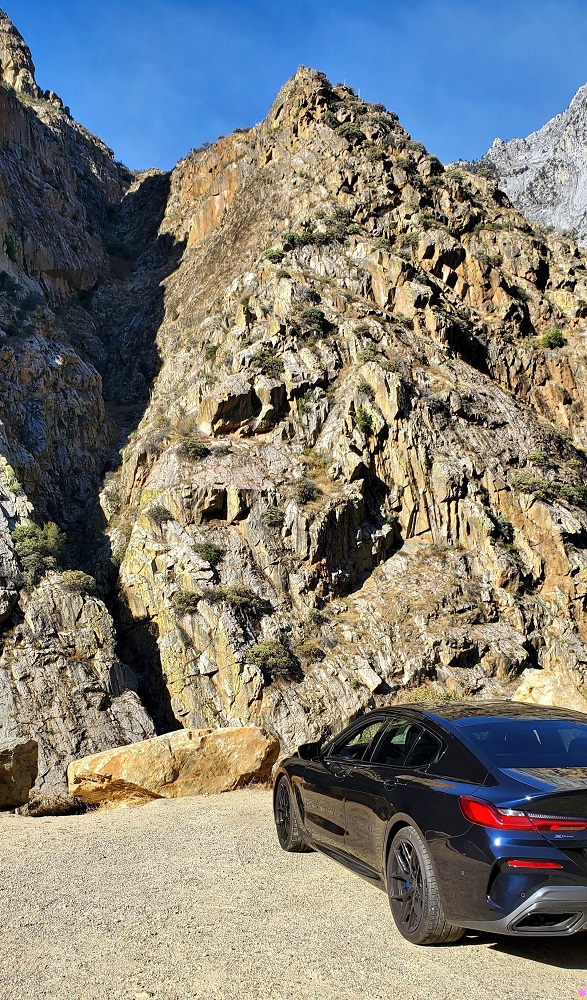
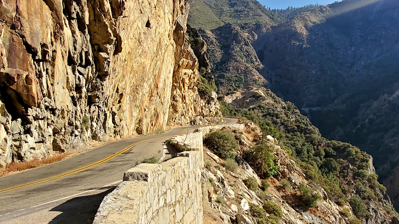
The landscape is dry and arid after a long hot summer. Yucca Point below.
208
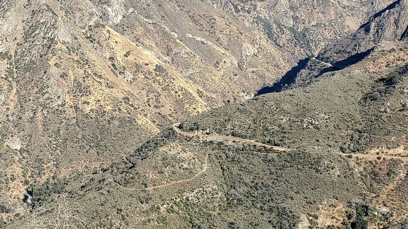
We descend thousands of feet and nearly reach the valley floor at Horseshoe Bend. 2nd pick is actually the wife's.
209

210
211

212
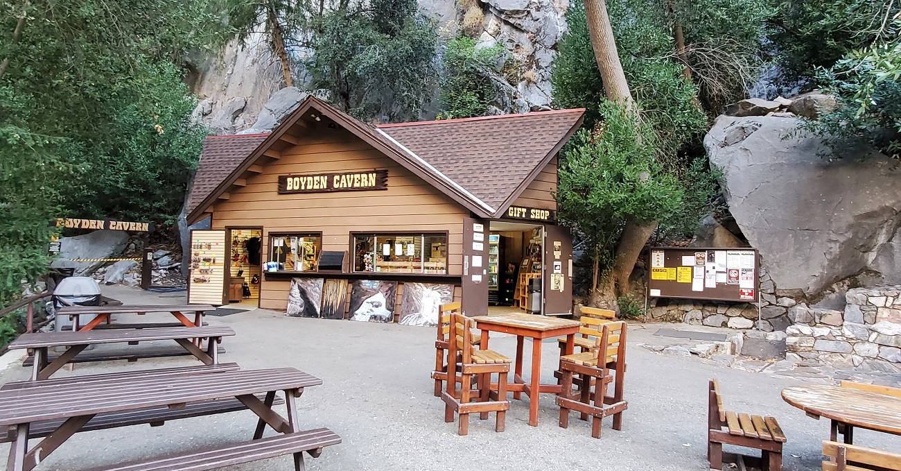
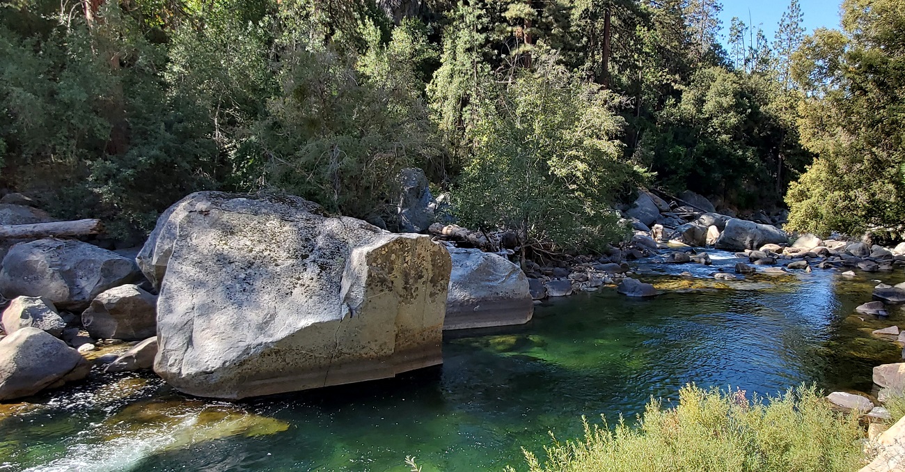
We finally make it down to the South Fork of Kings River. There's a little cavern tour here. Probably not quite like Carlsbad. We pass.
213
214
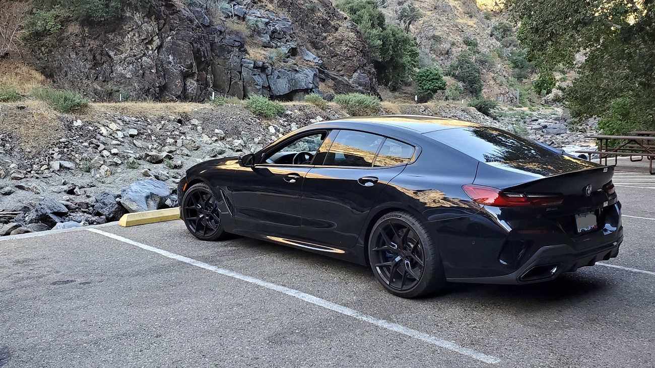
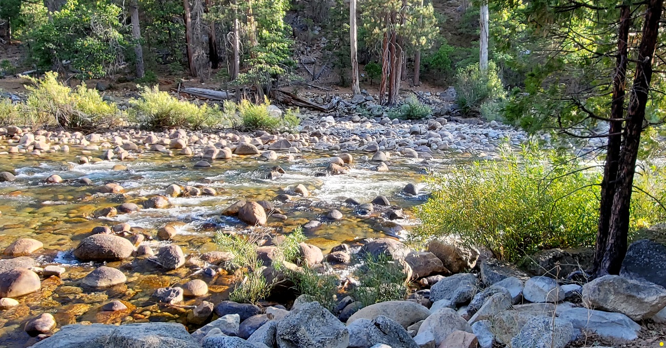
The river out front of our hotel. Just as we sat down a bear scurried along and out of sight across the river. Hmmmmm.
215
 Day 9: Cedar Grove to Oakhurst, CA - 151 miles
216

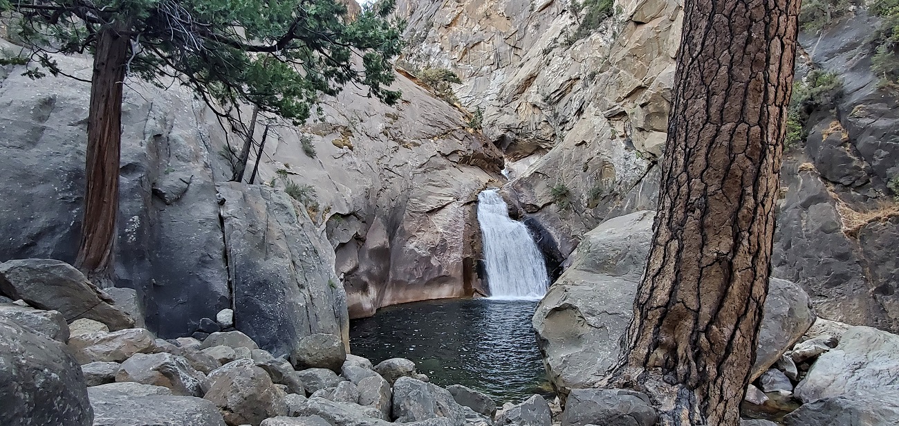
We are in the bottom of a canyon with mountains that rise steeply for thousands of feet. If you want to hike around here, you must go up. We are 6 miles from the end of the road. First up is little Roaring River Falls
217
The plan was to get to the road's end and hike out to a bridge along the river. But it's already hot, there's not much shade and the forest isn't very foresty. Plus, there's signs everywhere warning about bears. We can attest to that.
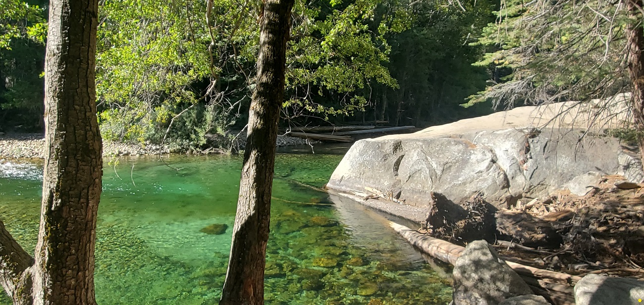
So we go over to Muir Rock and do a small hike in the nice part of the forest.
218

219
220
221
The flies and gnats are unbelievable. People are walking around in full head nets. We head for the car and say adieu to this part of Kings Canyon.
222

Coupla shots of the dryness as we wind back out of the valley.
223
224

225

226
Before long, we have regained thousands of feet and we're back at Junction View. The air is clearer today.
227
228
We've actually left Kings Canyon but re-enter it back at Grant Grove Village. We grab lunch and then head over to the Grant Grove of Giant Sequoias.
A nice path takes us through some big ones and then we meet up with the General Grant Tree. It is the worlds second largest Giant Sequoia, standing 268 feet tall and 107 feet in circumference at the base. It's a biggie.
229
230
It's a hundred miles to the hotel, so we wind ourselves out of the Sierras and head toward Fresno. We skirt the edges and hook on to CA Hwy 41 and make our way to Oakhurst.
Tomorrow is Yosemite Day. I think it's going to be good.